Navigating the Western Himalayas during the rainy season demands precise data and real-time administrative guidance rather than guesswork. To help you plan safe transit and understand regional weather variations, this comprehensive guide uses official data sourced directly from the India Meteorological Department (IMD) Meteorological Centre Shimla, the Himachal Pradesh State Disaster Management Authority (HPSDMA), and official state administrative bulletins [1][2][3].
State-Wide Overvie – Himachal Pradesh (Whole State)
According to the official long-range seasonal forecast issued by IMD Shimla, the 2026 Southwest Monsoon (June to September) across Himachal Pradesh as a whole is projected to be below normal, tracking at less than 92% of the Long Period Average (LPA) [1]. The normal baseline seasonal rainfall for the state stands at 734.4 mm [1].
However, state authorities emphasize that a below-normal seasonal projection does not rule out short, intense spells of localized extreme weather. This follows historically erratic monsoon patterns over the last 4–5 years:
- 2025: The state recorded its 15th highest monsoon rainfall in 125 years (and the highest in 29 years), receiving 1022.5 mm of actual precipitation—a 39% surplus over the normal baseline [2].
- 2024: Marked by highly fragmented distribution, featuring severe localized cloudbursts and delayed onset patterns across the mid-hill sectors.
- 2023: Witnessed historic catastrophic rainfall, causing widespread infrastructural damage, river swells, and an estimated $1 billion in state losses over a multi-year period [4].
To address these shifting dynamics, the HPSDMA and the National Disaster Management Authority (NDMA) executed their 10th state-wide mega mock exercises in June 2026 to optimize inter-agency communication resilience and traffic regulation along major national highways [3].
Regional Breakdown & Historical Trends
Shimla
The provincial capital is experiencing a highly active weather transition. While the overall 2026 seasonal outlook predicts below-normal cumulative rainfall relative to its baseline of 627.5 mm, the pre-monsoon phase recorded 291.5 mm of rain—42% above normal—accompanied by frequent hailstorms [1][5]. Historically, Shimla recorded large excess precipitation in 2025 during June and July, leading to severe saturation of steep slopes [2]. In response to recurring urban infrastructure pressures over the last four years, the Shimla District Administration issued strict preparedness mandates to identify landslide-prone road networks and monitor fragile retaining walls ahead of active monsoon spells [6].
Manali (Kullu District)
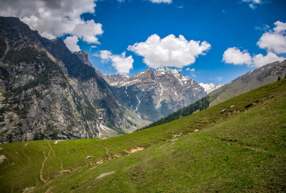
Manali’s baseline normal monsoon rainfall sits at 548.0 mm [1]. The 2026 local trend forecast indicates below-normal overall precipitation [1]. However, early season behavior remains unstable, with mixing weather patterns causing rain in the lower Kullu valley and fresh high-altitude snowfall at Rohtang Pass [7]. Looking back, the region experienced significant excess rainfall in 2025 [2], and severe flash flooding along the Beas River basin during the 2023 monsoon. Because of this historical vulnerability, local authorities actively monitor the upper catchment areas for sudden surges in water level [7].
Kinnaur
Bucking the broader state-wide dry trend, Kinnaur is expected to receive normal seasonal rainfall during the 2026 monsoon, relative to its lower baseline of 247.8 mm [1]. This marks a significant shift from the preceding years: the region suffered from a severe 47% rainfall deficit during the early months of 2026 [5], and registered a deficient monsoon overall in June 2025 [2]. Because the landscape consists of steep, high-altitude terrain, even normal rainfall can trigger shooting stones along the sheer rock faces flanking the National Highway corridors.
Dharamshala (Kangra District)
Kangra district holds the highest normal baseline rainfall in the state at a substantial 1622.4 mm [1]. For the 2026 season, IMD Shimla predicts below-normal cumulative rainfall for the region [1]. Historically, Dharamshala is prone to intense, short-duration downpours due to its position against the Dhauladhar range. While the district recorded a standard “excess” bracket during the opening weeks of the 2025 monsoon [2], sudden cloudbursts over the last 4 years highlight why it demands rigorous local drainage management and landslide monitoring.
Spiti (Lahaul & Spiti District)
Lahaul & Spiti stands out in the 2026 forecast with an above-normal seasonal rainfall projection against its historical baseline of 382.9 mm [1]. This is a major departure from recent history, as the rain-shadow desert zone recorded a “large deficient” precipitation status during July 2025 [2]. Because high-altitude desert terrain lacks the dense root systems and vegetation needed to bind soil, above-normal rainfall introduces a heightened risk of mudslides, flash floods in glacial streams (nullahs), and sudden road breaches.
🚦 Strategic Travel Routing & Safety Guidelines
Navigating Himachal Pradesh during the monsoon requires shifting from standard routes to a highly strategic approach. A single heavy downpour can alter road conditions within minutes. Use this framework to plan your transits safely.
🛑 Critical Routes to Avoid (High-Risk Corridors)
The following stretches are highly susceptible to structural damage, severe landslips, and flash floods. Avoid them entirely during heavy rainfall warnings:
- NH-3 (Mandi to Kullu via Pandoh): This low-lying river corridor is notoriously vulnerable. The highway runs directly alongside the Beas River, making it highly prone to flash floods, bank erosion, road cave-ins, and retaining-wall failures.
- NH-5 (Shimla-Kinnaur Highway): The stretch past Rampur and areas like Jeori and Jhakri face severe rockfall vulnerabilities. Even moderate rain can trigger dangerous “shooting stones” (falling boulders) down sheer vertical rock faces.
- Gramphu-Kaza Highway (Spiti Approach): The high-altitude crossing connecting Rohtang/Manali to Spiti via Kunzum Pass features multiple unbridled glacial streams (nullahs) like Chhota Dhara. These streams swell aggressively without warning during afternoon rains, completely stranding vehicles.
🟢 Recommended Safe-Transit Alternatives
If travel into the trans-Himalayan rain-shadow zone is essential during the monsoon months, route selection is everything:
The Bilaspur-Hamirpur-Kangra Highway: If you are heading toward Dharamshala or Dalhousie from Chandigarh/Delhi, stick to these well-paved, lower-altitude foothill highways rather than taking smaller interior link roads.
The Shimla-Kinnaur-Kaza Route: To reach the Spiti Valley, this approach is significantly more stable and gradual than the fragile ascent through Manali and the Gramphu corridor. While still requiring caution, the geographical gradient reduces the frequency of sudden mud-locks compared to the western passes.
Essential Safety Protocols
- Micro-Forecast Verification: Do not rely on generic, state-wide weather summaries. Always verify the district-specific, 24-to-48-hour micro-forecasts from IMD Shimla before cross-district transit [1].
- River and Reservoir Buffers: Never camp, park, or linger near active riverbeds or catchment basins (including the Beas, Sutlej, or Ravi rivers). Upstream dam gates (e.g., BBMB, Pandoh, Larji) can open with minimal warning based on sudden inflows from high-altitude zones [1].
- Diurnal Travel Safety: Avoid driving through mountainous stretches at night. Heavy downpours severely compromise visibility, and loose boulders (“shooting stones”) cannot be spotted on dark roads.
Highly Vulnerable Routes to Avoid
- NH-5 (Shimla-Kinnaur Corridor): Particular stretches past Rampur are highly susceptible to sudden rockfalls and landslips, even during light-to-moderate rainfall.
- NH-3 (Mandi-Pandoh-Kullu Stretch): This low-lying river corridor is prone to flash floods, road cave-ins, and retaining-wall failures during heavy downpours.
- Gramphu-Kaza Highway: The high-altitude approach into Spiti via Rohtang and Kunzum Pass features numerous unbridled glacial streams that swell rapidly, making it hazardous during active weather spells.
Recommended Safe-Transit Alternatives
- If you must travel to the high-altitude trans-Himalayan zones like Spiti during the monsoon, the Shimla-Kinnaur-Kaza route is generally considered more stable and reliable than the steep, fragile ascent through Manali and the Rohtang/Gramphu corridor. However, this route still requires you to check daily administrative road status updates before departure.
Choose a Native Partner for a Safe Journey
If you want to experience the raw beauty of the mountains without the stress of navigating unpredictable weather, traveling with experienced locals is the safest choice. At Himalayan Tribe, we are proud natives of Himachal Pradesh who have lived and breathed these mountains for generations. We understand the changing moods of the terrain, monitor real-time weather patterns directly from ground networks, and know exactly which routes are safe at any given hour. Our premium transit and guiding services are meticulously designed around seasonal safety protocols, ensuring that travelers from other states can explore our home safely, comfortably, and with absolute peace of mind.
Official Sources & References
- India Meteorological Department (IMD) Meteorological Centre Shimla – Long Range Forecast & District Baseline Reports
- IMD Shimla End of Season Monsoon Report (Historical Comparative Analysis 2010-2025)
- Himachal Pradesh State Disaster Management Authority (HPSDMA) State-Wide Preparedness Framework
- World Bank Board of Executive Directors – Resilient Action for Development and Disaster Recovery Project for Himachal Pradesh
- IMD Shimla Regional Climate Monitoring and Pre-Monsoon Analytical Bulletins
- Shimla District Administration Technical Disaster Preparedness Mandate
- Himachal Pradesh State Administration Travel Advisories and Emergency Traffic Regulation Guidelines